

image of barnstable county courthouse

January 22, 2026 | Winter Weather Update for Cape Cod & the Region

REPC logo with snow fall in the background

Dangerous Cold Expected Friday Night into Saturday

Very cold temperatures are expected Friday night into Saturday morning. Overnight temperatures will drop into the single digits to teens, and strong winds of 20–30 mph will make it feel even colder. These conditions can be dangerous for anyone spending extended time outdoors.

Snowstorm Possible Sunday into Monday

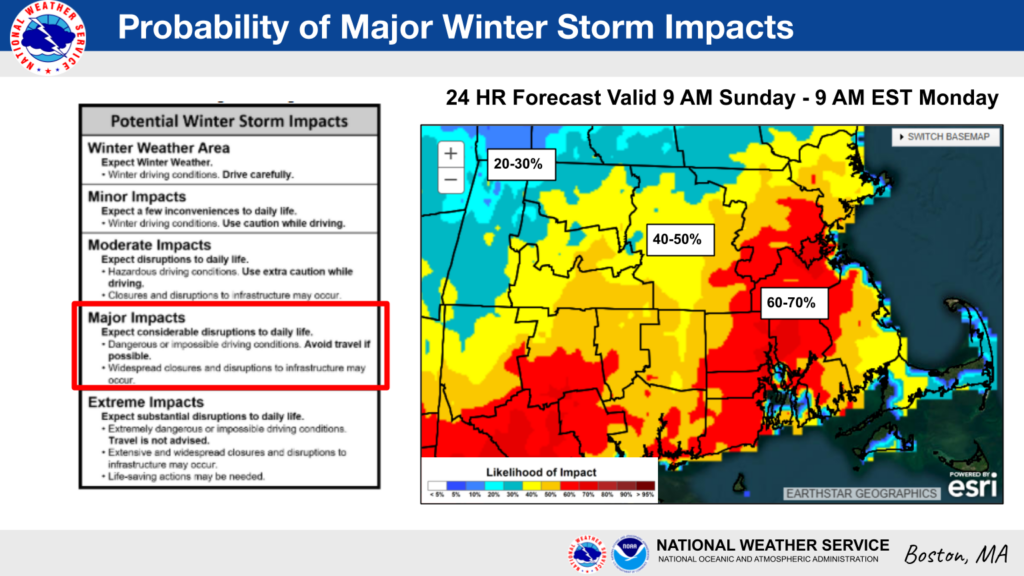
A snowstorm is possible Sunday into Monday. Forecast confidence is increasing, and the likelihood of 6 inches or more of snow has risen, along with the potential for moderate travel impacts. Snow is the primary concern, though exact snowfall amounts and timing are still being refined.

How to Prepare Now

Residents are encouraged to take simple steps now to prepare:

  • Check home heating systems and make sure smoke and carbon monoxide detectors are working
  • Charge phones and essential devices in case of power outages
  • Prepare vehicles for winter driving
  • Limit time outdoors during extreme cold and bring pets indoors
  • Check on neighbors, especially older adults or anyone who may need extra help
  • Plan ahead for possible travel impacts late Sunday into Monday

Additional updates will be shared as more information becomes available.
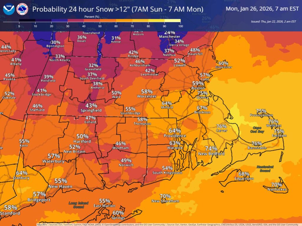
National Weather Service map showing the probability of more than 12 inches of snow over a 24-hour period from 7 a.m. Sunday to 7 a.m. Monday. Much of southern New England is shaded orange to yellow, indicating moderate to high probabilities. Cape Cod and the Islands show higher chances, generally around 70–75%, including Barnstable, Provincetown, and Nantucket. The map highlights increasing confidence in a significant snowfall event across the region.
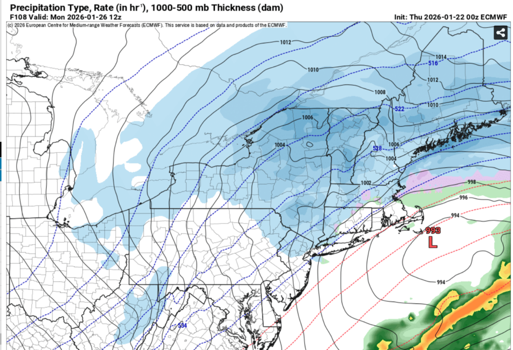
Weather forecast map showing snow as the primary precipitation type across much of southern New England, including Cape Cod, during the Monday morning period. Blue shading indicates widespread snowfall, with colder air in place across the region. A coastal low-pressure system is shown south of New England, supporting continued snow and windy conditions. The graphic illustrates why snow, rather than rain, is expected across most areas.
Weather forecast map showing widespread snow across much of southern New England, including Cape Cod, during the early morning hours Monday. Blue shading indicates snow as the primary precipitation type, with colder air firmly in place. A coastal low-pressure system is shown south of New England, supporting continued snowfall, strong winds, and potential travel impacts across the region.
The owner of this website has made a commitment to accessibility and inclusion, please report any problems that you encounter using the contact form on this website. This site uses the WP ADA Compliance Check plugin to enhance accessibility.