


Significant Winter Storm Possible Sunday into Monday | Updated: 8:00 AM | January 23, 2026
Published on: January 23, 2026
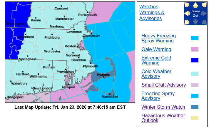
Barnstable County and the Cape & Islands region are closely monitoring a winter storm expected to impact southern New England from Sunday into early Monday.
Current forecasts indicate that cold air will be firmly in place, increasing the likelihood of snow across much of the region, with the heaviest snowfall expected Sunday night into the early hours of Monday.
What We Know Right Now
- A coastal storm system is expected to pass south of Cape Cod late Sunday into Monday morning.
- Snowfall is likely across the region, with the greatest uncertainty on the Cape and Islands, where some mixing with rain is possible, especially farther south.
- Based on current projections:
- Upper Cape and areas near the bridges: higher snowfall totals possible
- Mid to Lower Cape: somewhat lower totals due to mixing
- Nantucket: snowfall amounts may be reduced if mixing occurs
- Strong winds are possible Sunday night, with gusts up to 45–50 mph over the Cape and Islands, which could lead to reduced visibility and difficult travel conditions.
- At this time, significant coastal flooding is not expected, though conditions will continue to be monitored.
- Snow may linger into Monday, particularly across southeastern Massachusetts and parts of the Cape.
What’s Still Uncertain
- A slight shift in the storm’s track could significantly affect snowfall totals, especially for the Cape and Islands.
- Forecast confidence will improve as we move into the weekend and higher-resolution models become available.
Residents should plan now for hazardous travel conditions, especially Sunday night into Monday morning, and be prepared for potential power outages due to snow and wind.
➡️ Updated forecasts, alerts, and preparedness resources are available at:
www.capecod.gov/repc