

Weather Update for Barnstable County and Cape Cod | January 30, 2026, 6:35 AM
Extreme Cold Through Saturday | Potential Snow and Coastal Impacts Sunday–Monday
Barnstable County is monitoring weather conditions affecting Cape Cod and the Islands, including dangerous cold temperatures through Saturday and the potential for a coastal storm late Sunday into Monday, according to the National Weather Service.
Extreme Cold Through Saturday
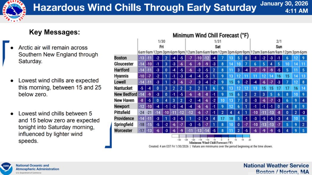
Arctic air remains in place across Southern New England, with hazardous wind chills expected through Saturday morning.
Wind chills may range from approximately –15°F to –25°F, with overnight low temperatures near 5°F to –5°F. These conditions can become dangerous quickly, particularly for anyone spending extended time outdoors. Residents are urged to limit outdoor exposure and take precautions to stay warm.
Weather Advisories and Watches
The National Weather Service has issued a Cold Weather Advisory for much of the region due to dangerous wind chills. Additional winter weather and coastal advisories or watches may be issued as the potential coastal storm approaches.
Residents are encouraged to stay informed and monitor official forecasts as conditions evolve.
Potential Coastal Storm and Snow Timing
Forecast confidence is increasing that a strong coastal storm will track offshore of New England Sunday into Monday.
For Cape Cod and the Islands, snow associated with this system may begin as early as Sunday morning, with the greatest potential for impacts occurring Sunday afternoon into Sunday night. Conditions are expected to gradually improve late Sunday night into Monday, though coastal impacts may persist around high tides.
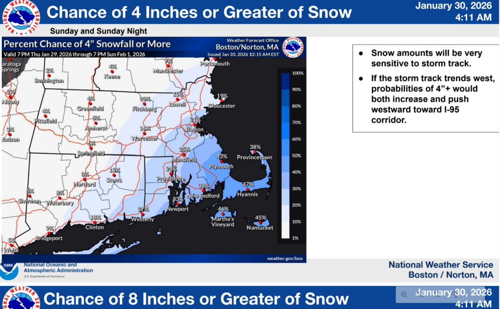
While snow accumulations are still uncertain, current guidance shows the potential for plowable snow on Cape Cod and the Islands. Snow amounts will depend heavily on the storm’s exact track, and confidence in specific totals remains limited at this time.
Potential impacts also include strong winds, hazardous travel conditions, minor to moderate coastal flooding, and beach and dune erosion.
How to Prepare
Residents are encouraged to take the following steps now:
Protect People
Limit time outdoors, dress in layers, and cover exposed skin. Check on elderly neighbors, family members, and anyone who may need assistance during extreme cold or winter weather.
Protect Pets
Bring pets indoors and limit their exposure to cold temperatures and icy conditions.
Protect Pipes
Allow faucets to drip slightly overnight, open cabinet doors under sinks to allow warm air to circulate, and ensure you know where your water shutoff valve is located.
General Preparedness
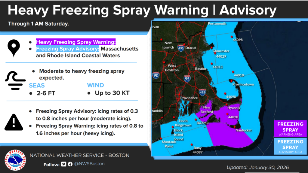
Charge phones and essential devices, review travel plans for Sunday and Monday, and complete preparations before Sunday morning if possible. Mariners should closely monitor marine advisories and avoid hazardous conditions.
Barnstable County will continue to share updates as forecast confidence increases and additional information becomes available.