High Winds and Rain Predicted Wednesday into Thursday
UPDATED Wednesday, 2/28/24, 9:30 AM
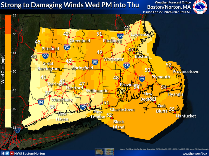
The National Weather Service has issued a High Wind Warning for the Cape and Islands, in effect from 7 AM this morning to 7 AM on Thursday. Southwest winds of 25 to 35 MPH with gusts up to 60 MPH are expected.
Two surges of winds are expected: the first surge will be Wednesday afternoon to evening with strong south winds. The long duration of south winds may enhance the wind damage potential across Cape Cod and the islands. The second surge will occur overnight Wednesday into Thursday morning, with strong to damaging northwest winds. Wind gusts on the Cape and Islands could reach as high as 55mph, causing potential for power outages.
Heavy windswept rain will likely cause hazardous travel Wednesday night. Rain is expected to briefly turn to snow as temperatures fall from the 50s on Wednesday evening, into the 20s behind an oncoming cold front. The temperature change will take place over only a one-to-two-hour timeframe. Snow accumulations are not expected to exceed 1″.
We will provide further updates as information becomes available.
For more information, please visit: Boston / Norton, MA (weather.gov)