
Significant Winter Storm Impacts Cape and Islands Tuesday, February 13
Updated Tuesday, February 13th at 4:30 PM
The National Weather Service has issued the following warnings for Cape Cod and the Islands. Blue highlighted text indicates recently updated information.
Winter Storm Warning: Set to expire at 7:00 PM on Tuesday, February 13th
The High Wind Warning has expired.
Coastal Flood Warning: Expires February 13, 5:00 PM EST. A Coastal Flood Advisory will be in effect for the early morning high tide on Wednesday, between 1:00 AM and 4:00 AM EST.
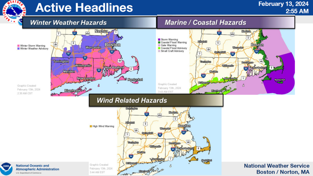
The snow is beginning to taper off in most areas as the storm moving off shore.
Wind: North winds of 20 to 30 mph are expected to continue into Wednesday morning.
Wintry Mix/Snow: Total snow accumulations of 4″ to 8″ are being reported across the Cape and Islands. Snow is beginning to subside as the storm moves offshore.
Coastal Flooding: Some coastal flooding may occur during the early morning high tide on Wednesday between 1 AM and 5 AM. As such, a Coastal Flood Advisory has been posted for that timeframe. Some coastal roads may become impassable. If travel is required, do not drive around barricades or through water of unknown depth.
Post-Storm Impacts: Gusty winds will continue into Wednesday afternoon, with gusts reaching up to 40 MPH in some areas. Temperatures will remain in the mid-20s to low 30s.
Follow us on Facebook >>> and Twitter >>> or visit our website at Emergency Planning Committee Archive – Barnstable County (capecod.gov).
For more information on the weather forecast, please visit Boston / Norton, MA (weather.gov).
Additional Resources:
It’s Time to Get Winter Ready – Barnstable County (capecod.gov)
Massachusetts Emergency Management Agency Situational Report #3
Storm graphics updated February 13 at 2:55 AM EST:
