Storm to Bring Heavy Rain, Coastal Flooding, Marine Impacts, and Wind to the Cape and Islands
Published on: January 9, 2024
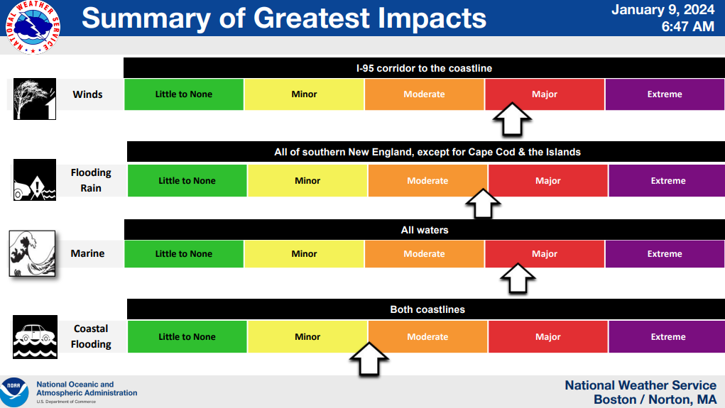
A second storm is approaching Cape Cod and the Islands, with impacts starting as early as Tuesday afternoon (today), and continuing through Wednesday, mid-morning. Unlike the previous storm which brought snow and freezing temperatures to much of Massachusetts, this storm will bring milder temperatures, significant rainfall, and potentially damaging winds.
Here’s what we know:
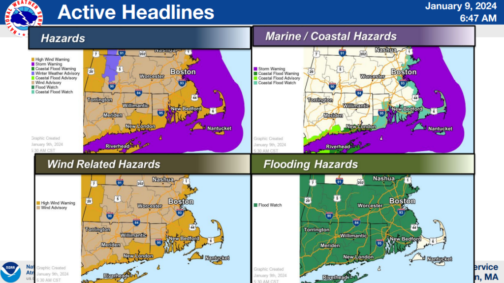
- Storm warnings have been issued for all of Massachusetts and Rhode Island Coastal Waters.
- A high wind warning has been issued for Cape Cod and the Islands, as well as most of interior Southeast Massachusetts.
- A coastal flood watch is in effect for eastern Massachusetts and the Islands.
Hazards are expected to include:
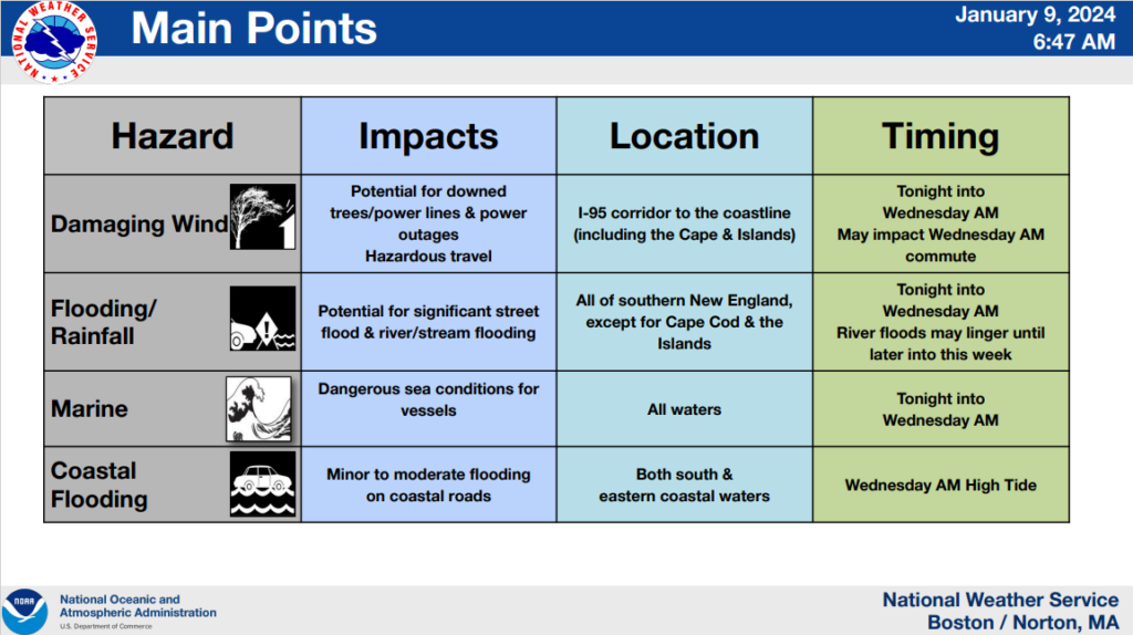
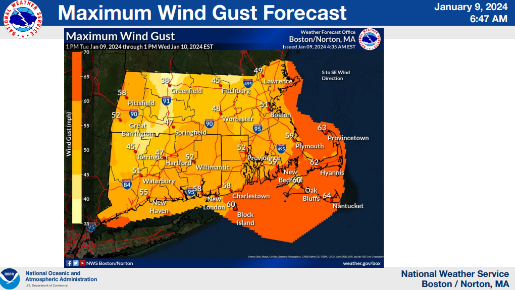
- The Cape and Islands will likely see wind gusts upwards of 60MPH Tuesday evening into Wednesday morning, bringing potential for downed trees/power lines & power outages. Travel will be hazardous and may impact the Wednesday AM commute.
- Dangerous sea conditions for vessels Tuesday afternoon/evening into Wednesday morning.
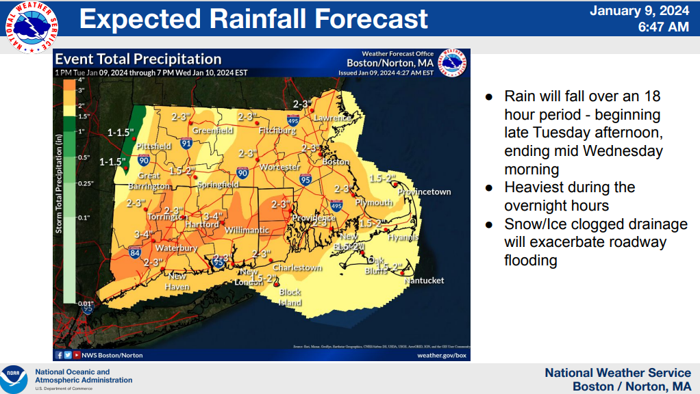
- 1 to 2″ of rainfall are expected for our region between late Tuesday afternoon and Wednesday morning, with the heaviest rains occurring during the overnight hours. Melting snow and ice will create flooding potential in rivers and roadways west of the Cape and Islands.
- Minor to moderate flooding is expected on coastal roads, especially during the Wednesday morning high tide, which will occur around 11am. Both south and eastern coastal waters will likely be impacted.
The storm will subside Wednesday afternoon/evening, with breezy conditions and seasonable temperatures late Wednesday through Thursday. Yet another storm system is anticipated late Friday into Saturday; details are pending.
For more information, please visit Boston / Norton, MA (weather.gov).