Winter Storm Saturday Night into Sunday; Greatest Impacts West of Cape Cod and the Islands
Published on: January 6, 2024
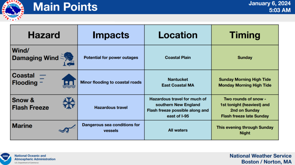
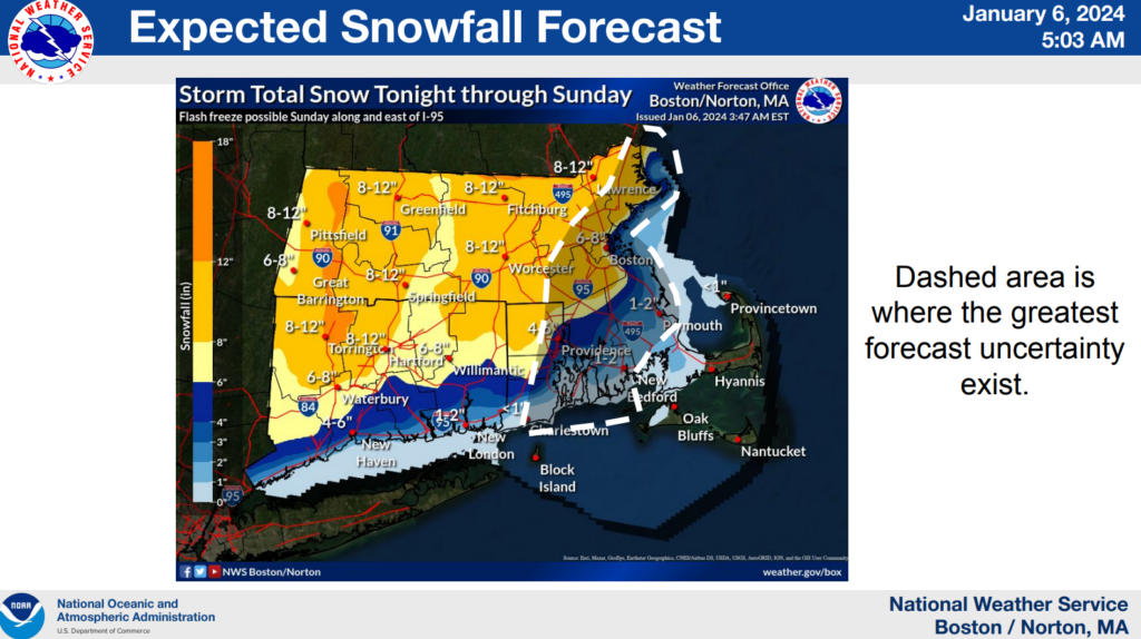
An approaching winter storm is expected to bring significant snowfall to most of Massachusetts, with far lower totals anticipated for Cape Cod and the Islands. Currently, Cape Cod lies in an area of uncertainty, and snowfall amounts will depend on some very specific (and somewhat less predictable) variables related to the timing and track of the storm. That said, we might see some wind and marine impacts, especially as the storm pulls away from our region. Here’s what we know so far:
- A Winter Storm Warning has been issued for the Boston area into Northern Rhode Island and Connecticut. A Winter Weather Advisory is in effect for the rest of Rhode Island and much of southeast Massachusetts, excluding Cape Cod and the Islands.
- Travel will be hazardous West of the I-95 corridor, where 6-12″ of snow accumulation are expected.
- A Wind Advisory has been issued for Cape Cod and the Islands.
- Mixing of precipitation is likely for Cape Cod and the Islands, with snow amounts decreasing further east towards the Outer Cape. Most areas of Cape Cod are not expected to see more than 1-3″ of snow, but the conditions will likely be wet and messy nonetheless.
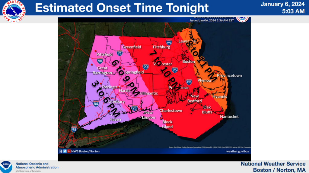
- Storm impacts are expected begin somewhere between 7pm and 11pm on Saturday.
- Estimated end time: 6PM to 9PM on Sunday evening.
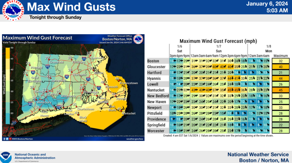
- Winds from the east will start to pick up Sunday morning as the storm pulls away from our area.
- A flash freeze could occur following the storm late Sunday.
- Cape Cod and the Islands could see gusts up to 50 MPH on Sunday.
Another winter storm is expected to impact our region with rain and wind Tuesday night into Wednesday; details are pending.
For more information, please visit Boston / Norton, MA (weather.gov).