
Storm Brings High Winds to Cape Cod and the Islands into Monday Afternoon (12/18)
Published on: December 18, 2023
A strong storm continues to impact Southern New England late Sunday into Monday afternoon with rain, strong winds, and minor coastal flooding.
UPDATE 12/18/2023, 9:30 AM: Info. from the National Weather Service (NWS) Boston/Norton
We are in the peak of the storm for damaging winds and flooding rainfall from now through roughly 12:00 PM, when conditions will slowly begin to improve.
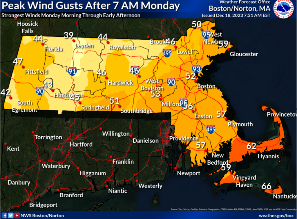
Damaging Winds: All of Southern New England
- Gusts of 50 to 70 MPH will continue through noon, with the highest gusts in Rhode Island and southeast Massachusetts, including Cape Cod and the Islands.
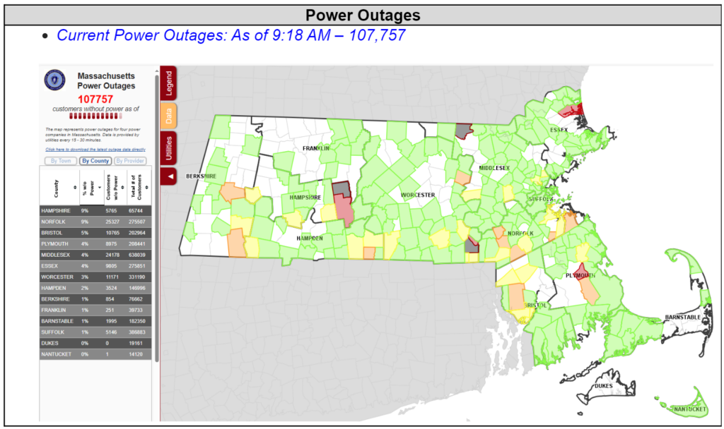
- Downed trees and wires may lead to power outages.
- Driving will be difficult, especially on bridges.
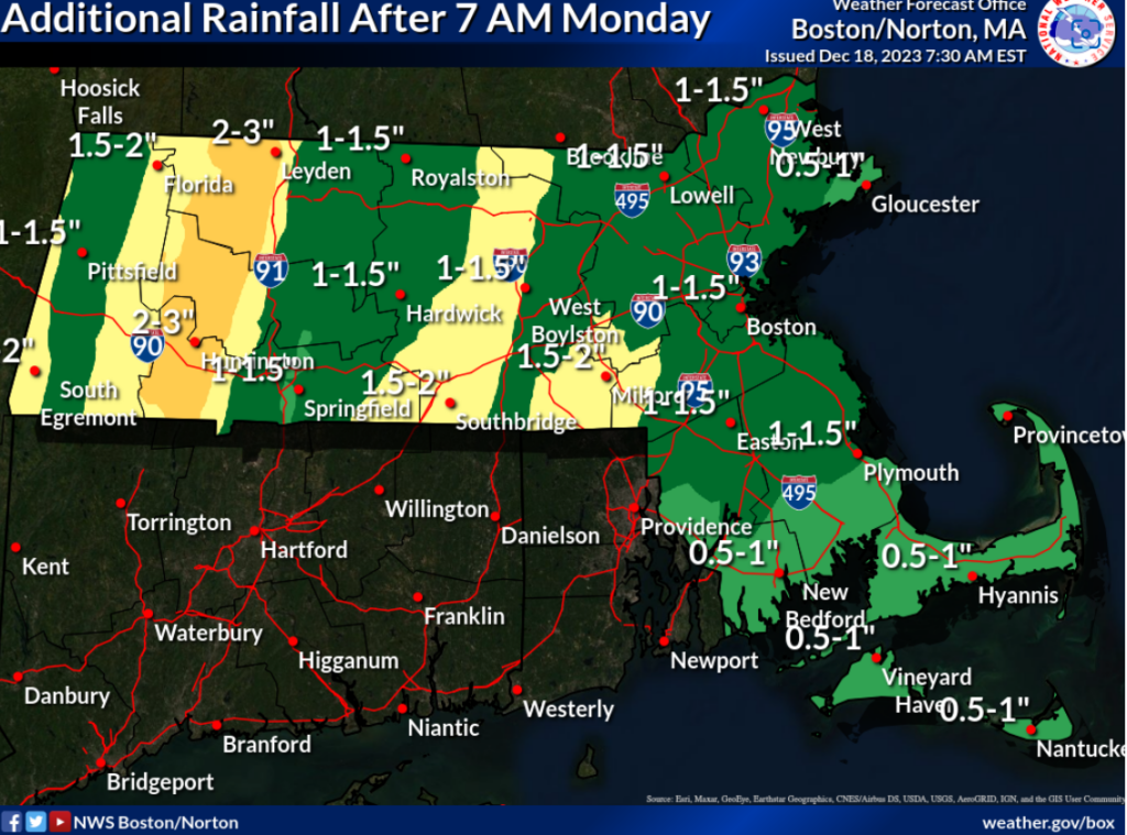
Flooding Rain: All of Southern New England
- More rain is expected today, with the highest totals near the Berkshires.
- High winds remain the biggest concern for Cape Cod an the Islands.
Coastal Flooding: South Coastal MA/RI
- Minor tidal flooding is expected elsewhere along the Rhode Island and Massachusetts South Coast. Flooding less than one foot deep will impact some coastal roads.
- Be aware that some coastal roadways may become impassable around high tide.
The following graphics were posted by National Weather Service Boston/Norton on December 18, 2023 at 7:00 AM.
For additional information, please visit Boston / Norton, MA (weather.gov).
