9/13/23 Afternoon Update: Hurricane Lee
Published on: September 13, 2023
This afternoon, the Massachusetts Emergency Management Agency (MEMA) hosted a daily statewide coordination call with local officials regarding the storm track and potential impacts of Hurricane Lee. Forecasted conditions were provided by the National Weather Service and MEMA’s meteorologist. These meetings will take place daily throughout the event.
NOTE: Please be aware that forecasted impacts from Hurricane Lee are subject to change depending on the storm’s speed and track. Updates will be provided as they become available.
Key Points for Cape Cod:
- Impacts from this storm are expected to be similar to a moderately strong Nor’easter.
- Tropical storm watches/warnings are likely for eastern MA, primarily Cape Cod and the Islands.
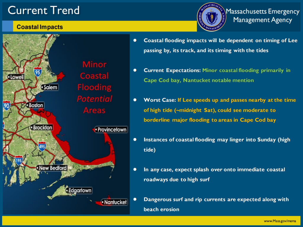
- At the very least, minor coastal flooding is anticipated primarily in Cape Cod Bay due to winds from the northeast. Worst case: if the storm speeds up and passes closer to peak high tide (around midnight on Saturday), Cape Cod Bay could see moderate to borderline major flooding. Instances of coastal flooding may linger into Sunday’s high tide.
- Dangerous surf and rip currents are expected along with beach erosion in Cape Cod Bay due to winds out of the northeast.
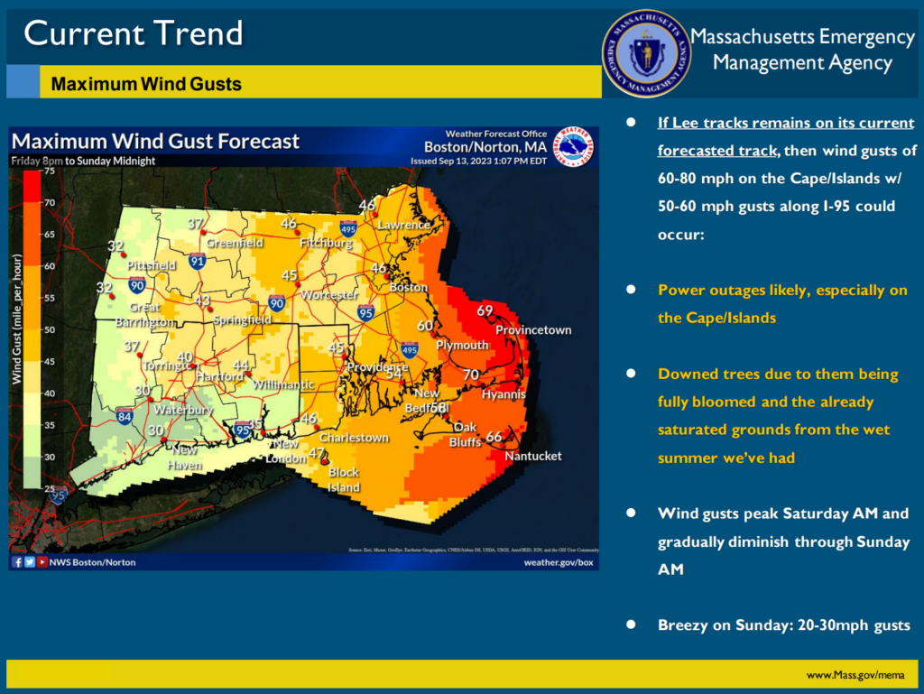
- If Lee remains on its current forecasted track, 60-80 mph wind gusts could occur. Peak winds are expected Saturday morning and will gradually diminish throughout Saturday night and into Sunday morning. Lee’s impacts will likely take place over a 12-hour timeframe.
- Downed trees and power outages are likely.
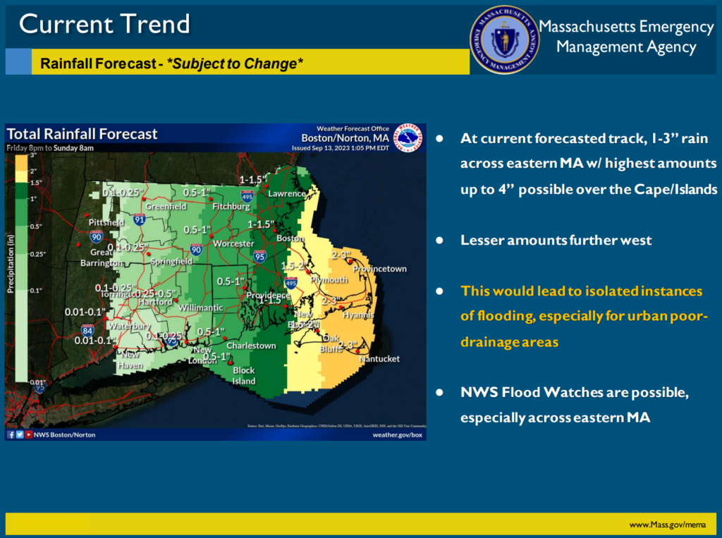
- Expected rainfall: 1-3″, up to 4″ in some areas on the Cape and Islands. *Rain totals would increase if the storm’s track shifts further west that is currently expected.
- Sunday’s forecast: dry and breezy with wind gusts of 20-30 mph.
Next Update: 9/14/23 (Thursday afternoon)