BCREPC Monitors Storm as Cape and Islands Experience High Winds, Rain, and Coastal Flooding
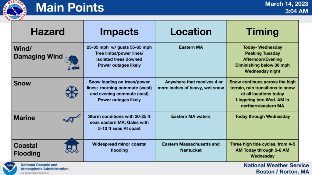
The Barnstable County Regional Emergency Planning Committee (BCREPC) continues to monitor the storm in progress that will continue to bring high winds, coastal flooding, and snow to our region through today (Tuesday), and into tomorrow (Wednesday).
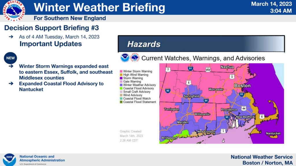
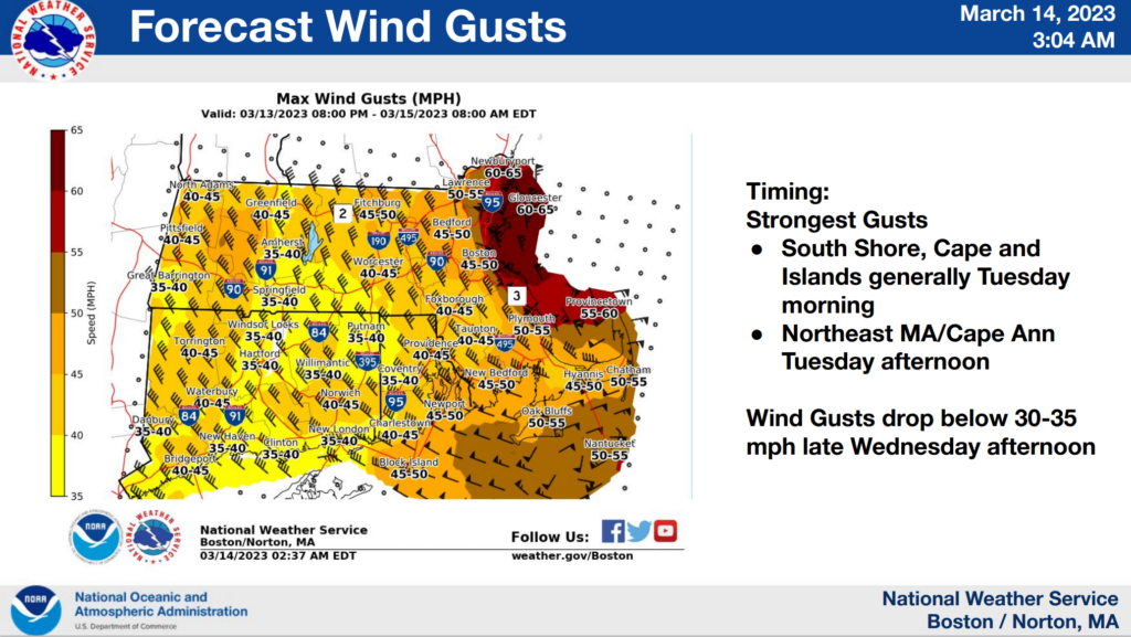
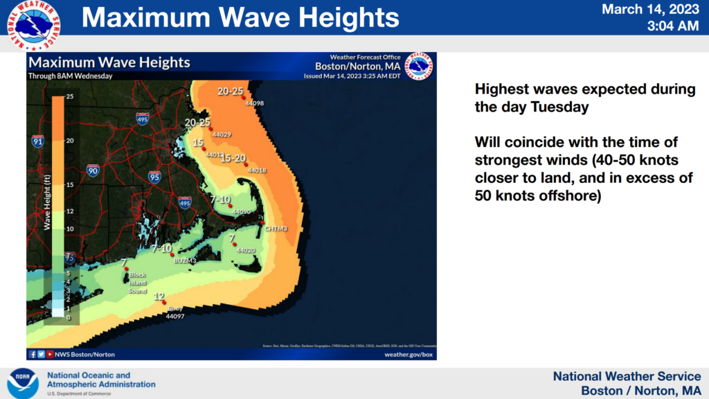
As of 4am Tuesday morning, a high wind warning and coastal flood advisory are in effect for the Cape and Islands, with a storm warning posted for coastal waters. Peak winds of 55 MPH to 60 MPH are expected to occur Tuesday afternoon into Tuesday evening, diminishing overnight.
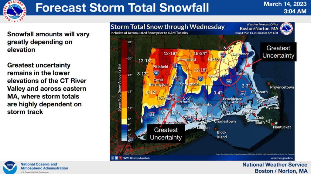
While the most impactful snow accumulations are predicted to occur in central and western Massachusetts, forecasters are anticipating a changeover from rain to snow here on the Cape around 6:00 PM Tuesday evening. While snowfall amounts for our region could vary depending on the storm track, 1″ to 2″ of snow are expected to fall in some areas as the system makes its way offshore. Weather is expected to improve on Wednesday.
In the event that power outages do occur, Eversource crews are on standby in our region to perform needed restoration efforts.
Updates will be provided as the situation develops. For more detailed state-wide weather forecasts and information, visit Boston / Norton, MA (weather.gov).