[January 16, 2022 – 8:30 AM] MEMA Weather Update – High Winds Expected for Cape Cod & Islands
Overview
The National Weather Service (NWS) is forecasting dry and very cold weather to continue across much of Massachusetts (MA) today.
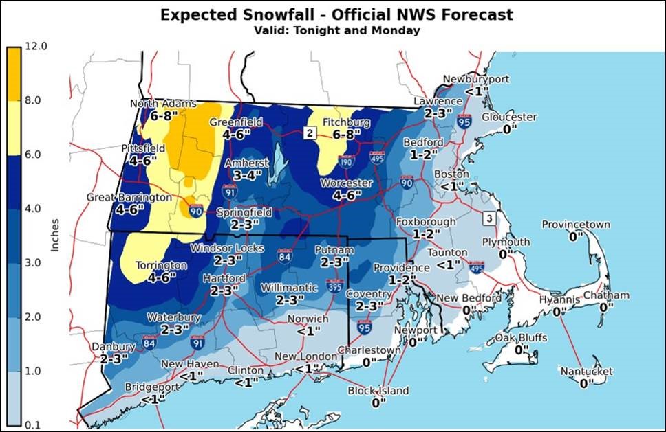
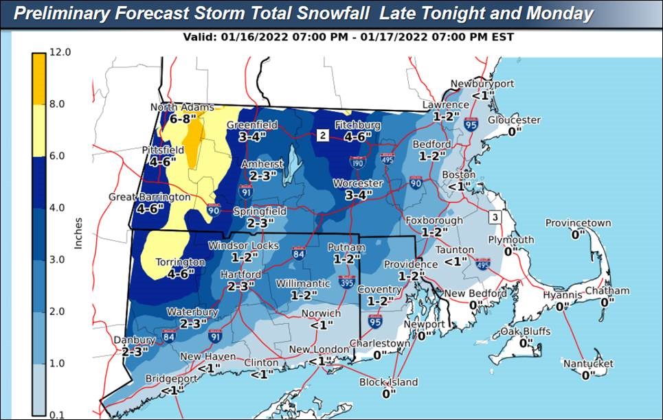
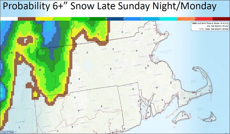
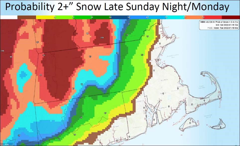
Snow and rain will develop across the state tonight ahead of a strong storm system. While there remains some uncertainty with the track of this storm if it follows the current forecast track snowfall is expected for all areas west of the I-95 corridor. The greatest risk for several inches of snow will be Northern Worcester County and the Berkshires where 6-8” of snow is expected. 3-6” of snow is expected in Western MA, and 2-4” of snow in Central MA however portions of this area may experience snow switching to rain for a brief period of time. 1-2” is expected in Eastern MA in areas west of the I-95 corridor. Regarding snowfall timing, the heaviest snowfall is expected to occur between midnight and 6 AM. There is high confidence that precipitation will be all rain along the east coast, and the Cape and Islands.
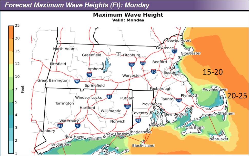
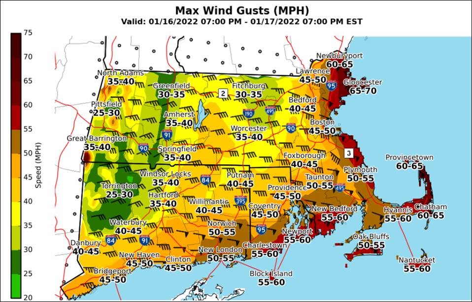
Additional concerns with this storm are damaging wind gusts of 50- 70 MPH along with coastal MA, the Cape, and Islands Monday morning, with wind gusts of 30- 45 MPH in the interior. Minor to pockets of moderate coastal flooding along the immediate coastline, especially in the Northshore are expected during the Monday morning high tide.
Monday morning, temperatures are expected to be climb above freezing across the state. By 7 AM, most locations across the state will experience rain however some portions of the state may experience a brief period of freezing rain or sleet early in the morning before changing over to all rain. The storm is expected to move out of MA by noon.
Impacts/Potential Impacts
Sunday Night into Monday:
- Snow may cause hazardous road conditions especially in the areas at greatest risk for several inches of snow.
- Damaging winds near the coast may cause power outages, especially along the coast, Cape Cod, and Cape Ann.
- For areas expecting all rain, minor street flooding is possible during the Monday morning commute.
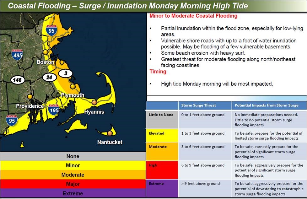
- Minor to pockets of moderate coastal flooding during the Monday morning high tide.
-
- Partial inundation within the flood zone, especially for low-lying
- areas
- Vulnerable shore roads with up to a foot of water inundation possible. There may be flooding of a few vulnerable basements
- Some beach erosion with heavy surf
The greatest threat for moderate flooding along north/northeast facing coastlines.
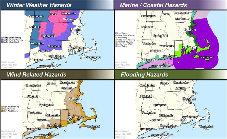
Advisories, Watches, Warnings
|
||||||||||||||||||||||||||||||||||||||||||||||||||||||||
| Electric Distribution Company (EDC) plans and preparations:
The Department of Public Utilities (DPU) and EDCs continue to monitor the weather forecast closely for a potentially strong, short-lived storm Sunday night into Monday as the track and intensity have the potential to change. At this time EDC plans and preparations are underway for the event and will continue to be formalized as the event nears Eversource:
National Grid:
Until:
|
Preparedness and Safety Information |
|
Preparedness and Safety Information |
|
Stay Informed |
| For additional information and updated forecasts, see www.weather.gov/boston (National Weather Service Norton) and www.weather.gov/albany (National Weather Service Albany)
Utilize MEMA’s real-time power outage viewer to stay informed about current power outages in your community and region, and across the state, including information from utility companies about restoration times: http://mema.mapsonline.net/public.html
|
Online Resources |
| Massachusetts Emergency Management Agency www.mass.gov/mema MEMA’s Facebook page http://www.facebook.com/MassachusettsEMA MEMA Twitter @MassEMA Federal Emergency Management Agency www.fema.gov National Weather Service Boston/ Norton, MA www.weather.gov/boston National Weather Service/Albany, NY www.weather.gov/albany National Weather Service Weather Prediction Center www.wpc.ncep.noaa.gov National Weather Service Storm Prediction Center www.spc.noaa.gov Northeast River Forecast Center www.weather.gov/nerfc/ National Hurricane Center www.nhc.noaa.gov Mass211 www.mass211.org |