[November 12, 2021 – 12:18 PM ] Weather Update
Strong to damaging winds and heavy rain will affect the southern New England region today.
Synopsis
A deep closed low over the western Great Lakes will push a front through southern New England today.
Discussion and Forecast
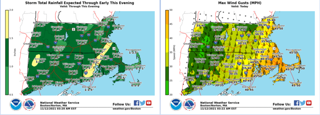
Trough and associated front is pushing through southern New England at this time. A strong low-level jet and good precipitable water values will pull 1-1.5” of rainfall through the region from now until around 7:00 pm this evening. Good forcing for ascent will lend to thunderstorm development in the strong southerly flow. Rainfall over 2” could occur in some areas if any of these storms pass near along with the general rainfall area.
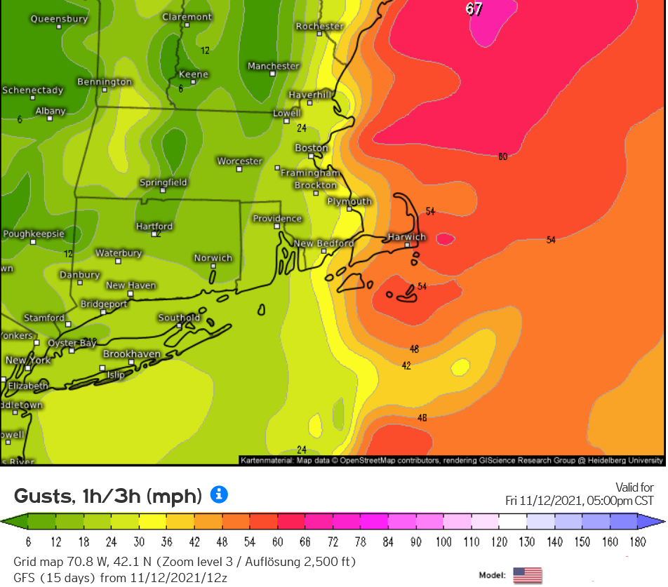
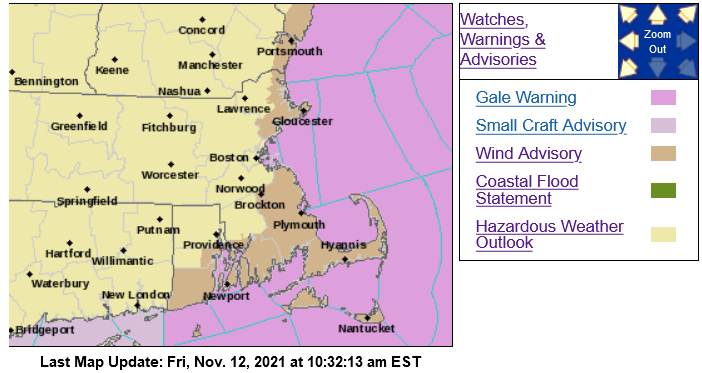
The main issue will be wind. A solid low-level jet out of the south near 72kts will bring winds of near 40mph in many parts of the area. Typically, an inversion in the atmosphere keeps the strongest winds aloft. Still, soaring temperatures into the mid-60s could allow some of these winds to mix down to the surface: This is especially true along the south coast of MA, the Cape/Islands, and NE coastal MA, where winds could gust near 50mph with some isolated 55mph gusts. Wind advisories are up for these areas.
There is also the potential for a few thunderstorms to become severe: This is a high shear environment with good helicity (turning in the atmosphere). There is a low potential for a waterspout or two along with an isolated weak tornado. The more significant threat is for straight-line winds from any thunderstorms that can mix down the winds sufficiently.
We will need to watch for potential tree and limb damage along with possible scattered power outage potential. The system is moving along progressively, and we should begin to see improving conditions after 7 pm.
Provided by Frank O’Laughlin, Meteorologist