Accumulating Snow Forecasted for Friday, January 19th; Sub-zero Wind Chill Temperatures this Weekend
Published on: January 18, 2024
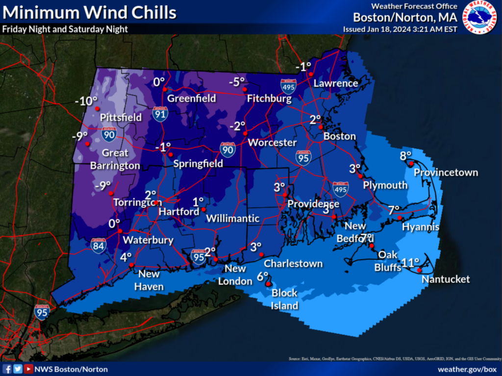
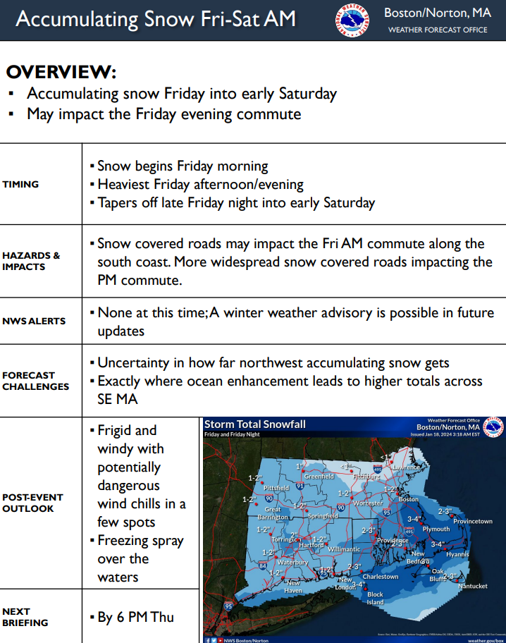
Snow is expected to impact the Cape and Islands Friday and Friday evening, with sub-zero wind chill temperatures this weekend. There is also an increasing risk for moderate to heavy freezing spray Friday night through Saturday night. Here’s what we know:
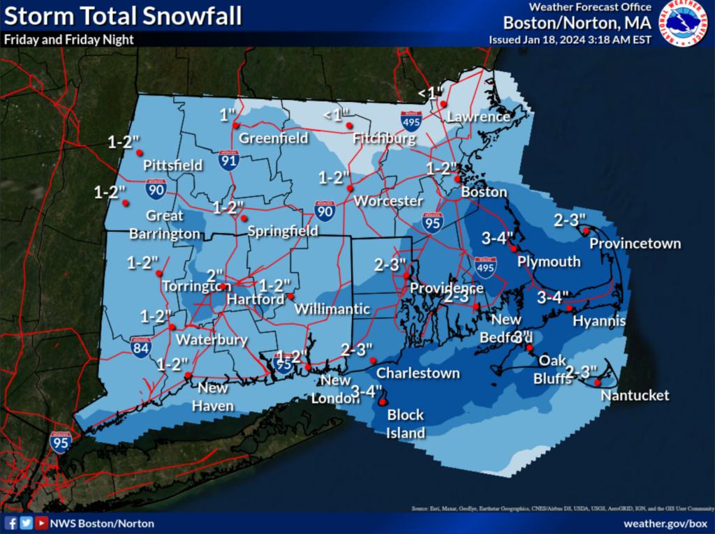
- Snow begins Friday morning, with heaviest snow occurring Friday afternoon and evening. Snow tapers off late Friday into early Saturday. Accumulation could reach up to 4″.
- Snow covered roads may impact the Friday AM and PM commute.
- Frigid wind with potentially dangerous wind chills Is likely, as well as freezing spray over marine waters.
For more information, visit Boston / Norton, MA (weather.gov).
Additional Resources:
It’s Time to Get Winter Ready – Barnstable County (capecod.gov)
Extreme Cold Safety Tips | Mass.gov
Infographic: Be Ready! Winter Weather | CDC
Images