Another Storm to Bring Wind, Rain, and Coastal Flood Warnings Early Saturday Morning
Published on: January 12, 2024
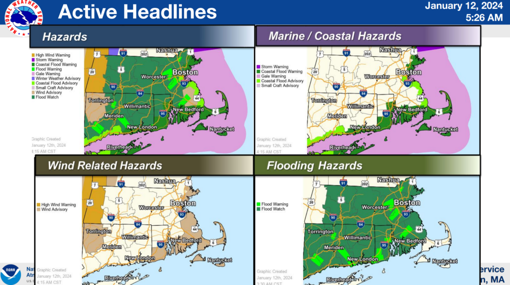
Yet another storm system will make its way into our region early Saturday morning into Saturday afternoon. This storm will be similar to the last in terms of timing, rain totals, wind, and coastal flooding. Here’s what we know:
- A Wind Advisory is in effect for Saturday, January 13th from 1:00 AM until 4:00 PM, with the strongest wind gusts likely to occur between 3AM and 9 AM on Saturday.
- West to southwest wind gusts up to 50 MPH are expected.
- Gusty winds could blow around unsecured objects.
- There is a potential for scattered power outages.
- Expected rain totals: 1-1.5″
- A Coastal Flood Warning is in effect for Saturday, January 13th from 1:00 AM until 4:00 PM.
- Up to one foot inundation above ground level is expected in low-lying areas near shorelines and tidal waterways. Areas of concern for minor flooding at approximate peak high tide include:
- Provincetown Harbor – Peak high tide: 12:00 PM – 12:30 PM
- Dennis/Sesuit Harbor – Peak high tide: 12:00 PM – 12:30 PM
- Wings Neck – Peak high tide: 9:00 AM – 9:30 AM
- Up to one foot inundation above ground level is expected in low-lying areas near shorelines and tidal waterways. Areas of concern for minor flooding at approximate peak high tide include:
If travel is required on Saturday, do not drive around barricades or through water of unknown depth. Homeowners should take necessary actions to protect flood prone property.
For additional information, please visit Boston / Norton, MA (weather.gov).