National Weather Service Warns of Dangerous Heat and Potential for Severe Storms
While the risk for severe weather on Cape Cod is less than the rest of the state, residents and visitors are advised to consider the weather while making outdoor plans Thursday July 27 through Saturday July 29th.
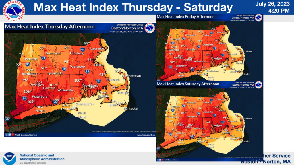
Dangerous Heat
A heat advisory remains in effect from Thursday morning through Friday evening for most of Massachusetts, excluding the Cape. That said, temperatures are still anticipated to rise into the 90s, so plan accordingly! CLICK HERE for tips on how to protect yourself and your family when temps are on the rise.
Severe Weather
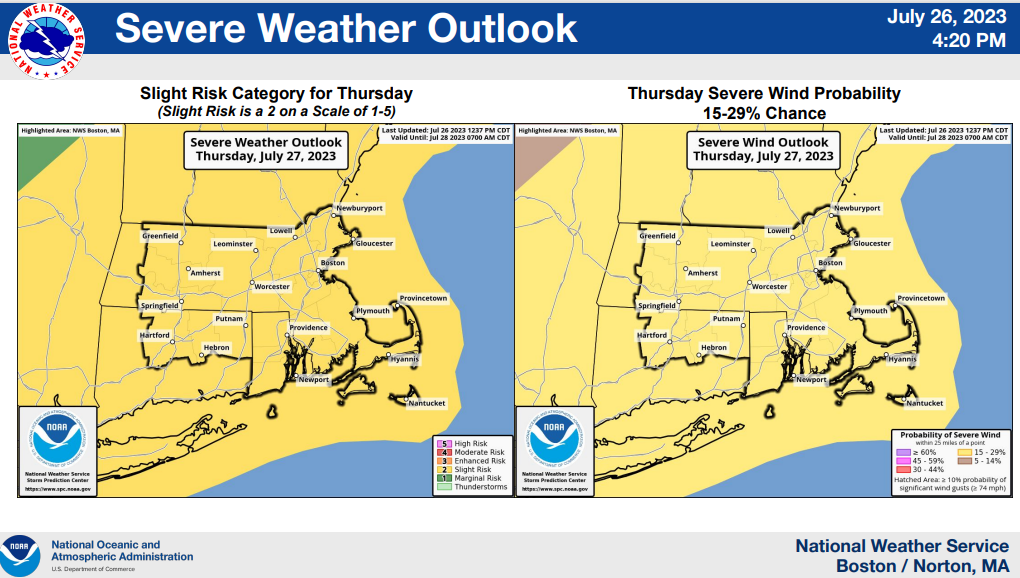
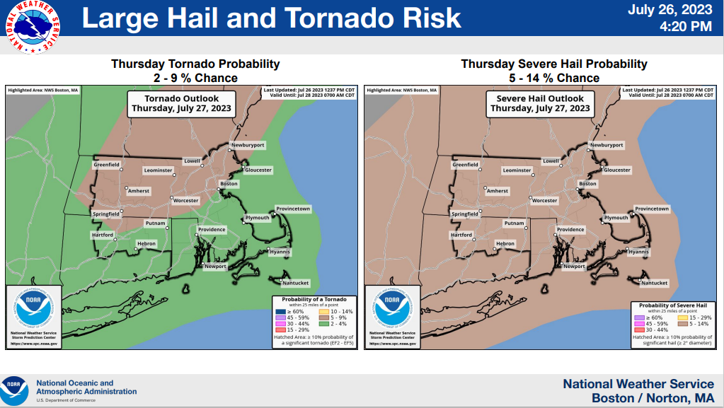
Again, severe weather is more likely in central and western Massachusetts than it is on the Cape. However, the National Weather Service has placed our region at “slight risk” for severe weather including high winds, with low probability of a tornado or severe hail. It’s important to be aware unpredictable weather can occur under these conditions and at this time of the year.
- Scattered severe storms will be most likely between 2pm and 10pm on Thursday.
- Most likely hazard with severe storms is damaging straight line wind gusts, but there is also a risk for both large hail and a few tornadoes.
- A flood watch is in effect for most of MA (again, excluding Cape Cod) north of the CT border tomorrow morning through Thursday evening.
For more information and up-to-date weather, visit the National Weather Service website.