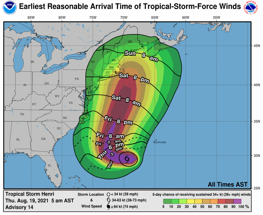
[5:00 AM] August 19, 2021 | Update: Tropical Storm Henri Potential Impacts to Cape & Islands
Tropical Storm Henri UPDATED 1130z 08-19-21
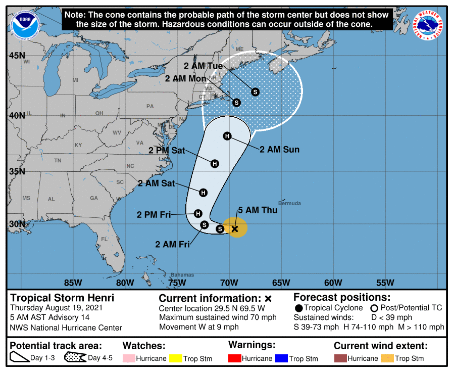
SUMMARY OF 500 AM AST…0900 UTC…INFORMATION
———————————————-
LOCATION…29.5N 69.5W
ABOUT 525 MI…845 KM SE OF CAPE HATTERAS NORTH CAROLINA
ABOUT 810 MI…1300 KM S OF NANTUCKET MASSACHUSETTS
MAXIMUM SUSTAINED WINDS…70 MPH…110 KM/H
PRESENT MOVEMENT…W OR 260 DEGREES AT 9 MPH…15 KM/H
MINIMUM CENTRAL PRESSURE…995 MB…29.39 INCHES
Discussion and forecast
Cape Cod and the Islands and Southeast Massachusetts will potentially be affected by Tropical Storm Henri. A track just offshore would provide damaging winds, very heavy rain and coastal flooding along eastern and northeastern facing coastal sections. As tides are astronomically high this weekend, some south side surge would occur as well.
Now is the time to plan for these potential impacts. You can find tips at ready.gov/hurricanes