Weather Update: April 12, 2020
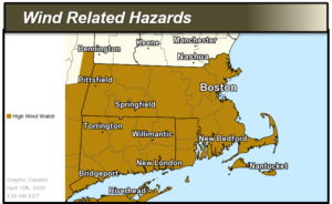
A High Wind Watch and Storm Watch is in effect for Barnstable, Nantucket and Dukes Counties. There is a potential for damaging wind gusts and power outages on Monday, April 13, 2020.
The greatest time of concern is late Monday morning into early Monday evening. Scattered to widespread power outages are possible due to downed trees, tree limbs and power lines. It may be difficult travel for high profile vehicles.
- High Wind Watch for all of southern New England from Monday morning until Monday evening
- Storm Watch in effect for the ocean waters from Monday morning into Monday evening
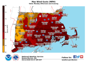
Southerly wind gusts of 55 to 70 mph are possible late Monday morning through Monday evening, with sustained winds of 20-40 mph. Greatest time of concern is late Monday morning into early Monday evening. The highest winds are expected across Rhode Island and southeast Massachusetts including Cape Cod and the Islands, but damaging wind gusts are possible across all of southern New England.
Heavy Rain:
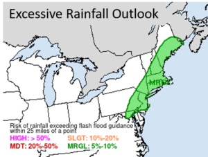
Rainfall amounts of 1 to 2 inches are possible from late Sunday night through Monday. Locally higher amounts are possible where any thunderstorms move through. Heavy rain may cause brief localized urban and poor drainage flooding.
Thunderstorms:
Thunderstorms will be possible ahead of a cold front Monday afternoon and early Monday night. Some of these storms could become severe bringing damaging winds, lightning and heavy rain.
The Multi Agency Coordination Center (MACC) will be on stand by for this event.