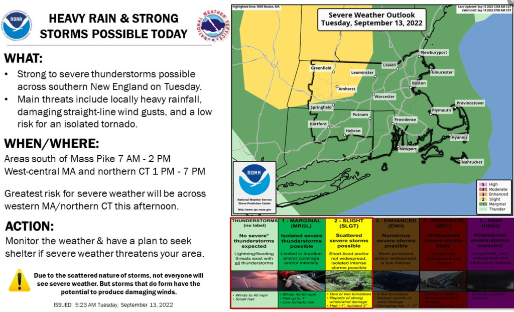
Severe Weather Potential for Tuesday, September 13th
September 13, 2022 | A warm front is expected to move ENE along coastal waters into the early afternoon on Tuesday. The front brings a wet airmass that could deposit heavy rainfall as the area of convection crosses around 2-3pm. There is also some atmospheric shear with a potential for rotation with this event, which could cause an isolated water spout or a brief tornado spin up. The main threat for Cape Cod, however, is brief wind gusts and heavy rain in some spots.
For important weather updates, follow the Massachusetts Emergency Management Agency (MEMA) on Facebook Massachusetts Emergency Management Agency (MEMA) | Facebook, as well as the US National Weather Service in Boston US National Weather Service Boston MA | Facebook. The BCREPC will continue to post updates as they pertain to our region.