[10:00 AM] Update on Tropical Storm Henri and Potential Impact on Cape Cod & Islands
Discussion and Forecast
Tropical Storm Henri continues to experience strong shear near 20-25kts. This has held down any intensification stage thus far, but shear is forecast to slacken down to near 10kts by tonight. This will allow the cyclone to take advantage of the 29C (84F) sea surface temperatures it will be traversing during the next 36 hours.
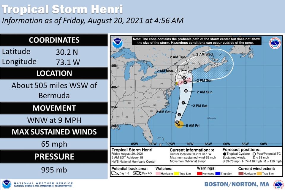
Henri is forecasted to be near an 85mph Hurricane just before it reaches the cooler waters of Southern New England. We continue to monitor this closely. Henri could still be a 75mph Hurricane as it reaches its landfall point.
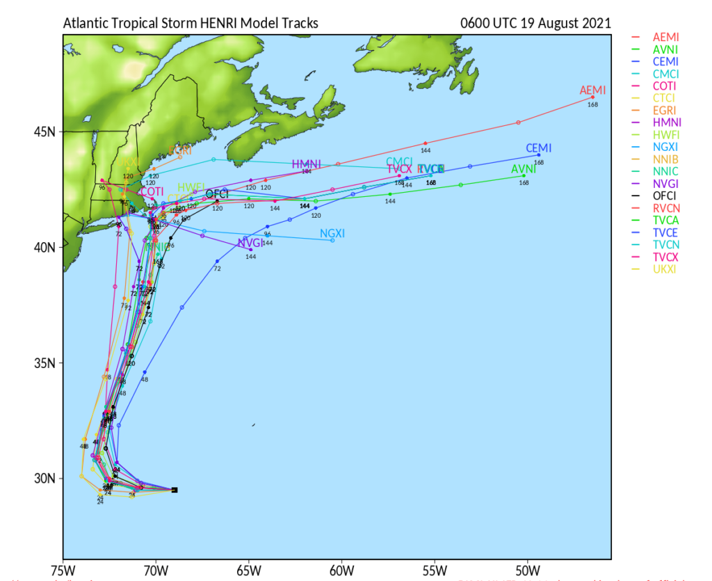
Track reasoning for Henri has been difficult and problematic throughout. Henri is now moving WNW as it is about to make the anticipated turn to the north today. Henri is being drawn to the north by a trough in the eastern US. As it moves north it will be pushed slightly to the left as high pressure ridging to the northeast of the system will attempt to keep it from slipping out to sea before reaching the southern New England coast.
Most of the consensus guidance now has a direct landfall on the southern coast of New England somewhere between RI and the south coast of MA. Tracks have continued this change to the west for the last day or so.
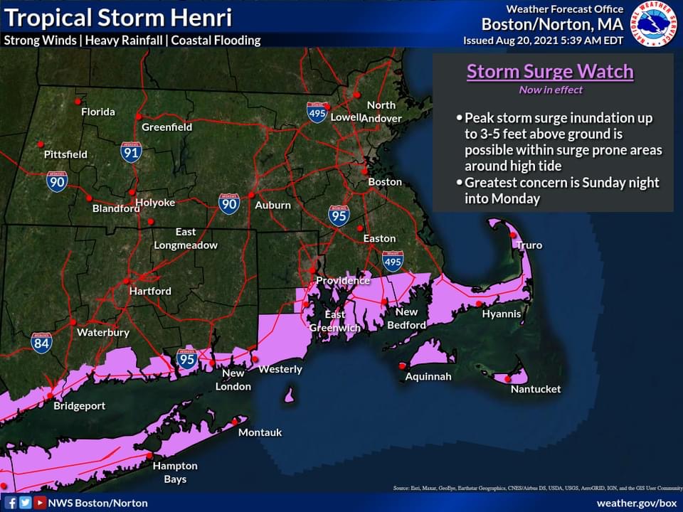
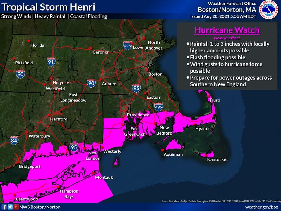
A landfall along this area will present a variety of hazards. Most of the rainfall will be along the landfall point and westward. Most of the surge and damaging southerly winds will be east of where the center crosses the coast. As a tropical system moves into the southern New England area, its wind field begins to expand significantly. This means that a storm even more than 100 miles to the west of Cape Cod could still produce hurricane force winds in that area. This has great historical precedence from past events. Tropical storm force winds will likely reach the coast during Saturday evening well ahead of the arrival of Henri on Sunday. Storm surge values from 3-5 feet are likely, especially on south facing coastal locations. With the astronomical tides being higher this weekend, east and northeast facing coastal areas will also see some water rise.
Check back for more updates on bcrepc.org