[8:00 AM] June 30, 2021 | Oppressive Heat Continues/ Severe Thunderstorms Today
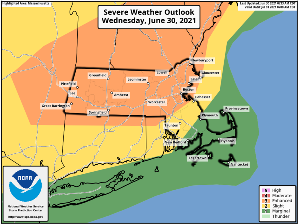
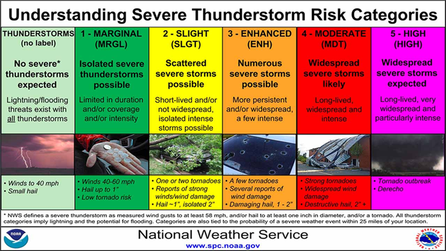
Strong to severe thunderstorms are expected today with an approaching cold front. The Storm Prediction Center (SPC) has placed much of state in the areas from Western to Eastern MA at enhanced risk for severe weather, Southeastern MA at slight risk, and the Cape and Islands at marginal risk. In terms of timing, thunderstorms are expected between the hours of 2 PM and 10 PM. The primary threat with these storms is strong to damaging wind gusts of 50- 70 mph, hail, frequent lightning, localized heavy downpours, and flooding.
For Thursday, rain showers will develop late morning with a few thunderstorms possible Thursday afternoon. Rain could be heavy at times and periods of rain will continue across the state Thursday night with thunderstorms ending Thursday evening. The chance for showers will continue through the day Friday along with the chance for an isolated thunderstorm.


Impacts/Potential Impacts
Heat:
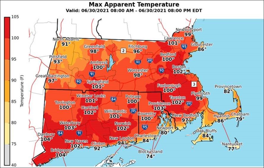
- Prolonged period of oppressive daytime heat and humidity dangerous to those outdoors.
- Strong to severe thunderstorms for Wednesday:
- Damaging straight-line winds with gusts up to 50-70mph. Downed trees and powerlines, and isolated structural damage associated with the strongest storms
Forecast Overview
Heat advisories remain in effect until 8:00 PM tonight except for Cape Cod and the Islands. For the latest NWS advisories, watches and warnings in MA visit https://alerts.weather.gov/cap/ma.php?x=1
- Safety and preparedness tips for tornadoes:
https://www.mass.gov/info-details/tornado-safety-tips - Safety and preparedness tips for extreme heat:
https://www.mass.gov/info-details/extreme-heat-safety-tips - Power outage preparedness and safety information:
https://www.mass.gov/info-details/power-outage-safety-tips - Preparedness and safety tips for thunderstorms and lightning: https://www.mass.gov/info-details/thunderstorm-and-lightning-safety-tips
Preparedness/Safety Information
Flood safety tips:
https://www.mass.gov/info-details/flood-safety-tips
Stay Informed
For additional information and updated forecasts, see www.weather.gov/boston (National Weather Service Norton) and www.weather.gov/albany (National Weather Service Albany)
Utilize MEMA’s real-time power outage viewer to stay informed about current power outages in your community and region, and across the state, including information from utility companies about restoration times: http://mema.mapsonline.net/public.html
Massachusetts Emergency Management Agency www.mass.gov/mema
MEMA’s Facebook page http://www.facebook.com/MassachusettsEMA
MEMA Twitter @MassEMA
Federal Emergency Management Agency www.fema.gov
National Weather Service Boston/ Norton, MA www.weather.gov/boston
National Weather Service/Albany, NY www.weather.gov/albany
National Weather Service Weather Prediction Center www.wpc.ncep.noaa.gov
National Weather Service Storm Prediction Center www.spc.noaa.gov
Northeast River Forecast Center www.weather.gov/nerfc/
National Hurricane Center www.nhc.noaa.gov
Mass211 www.mass211.org


