December 16, 2020 Weather Update 4:30 PM | Winter Storm Warning for Barnstable County Tonight and Thursday
Published on: December 17, 2020
- Upgraded to a Winter Storm Warning for Barnstable County
- Hoisted High Wind Warnings for the Islands
- Upgraded to Storm Warnings across all Southern Waters
- Increased snowfall across NE MA, NE CT, and Northern RI
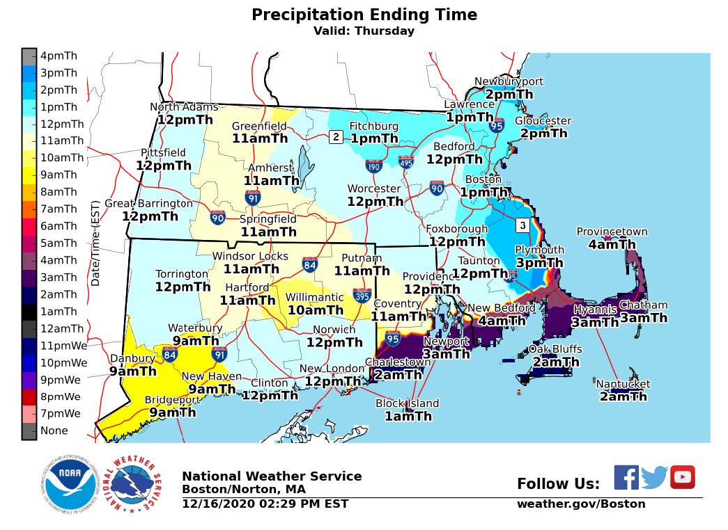
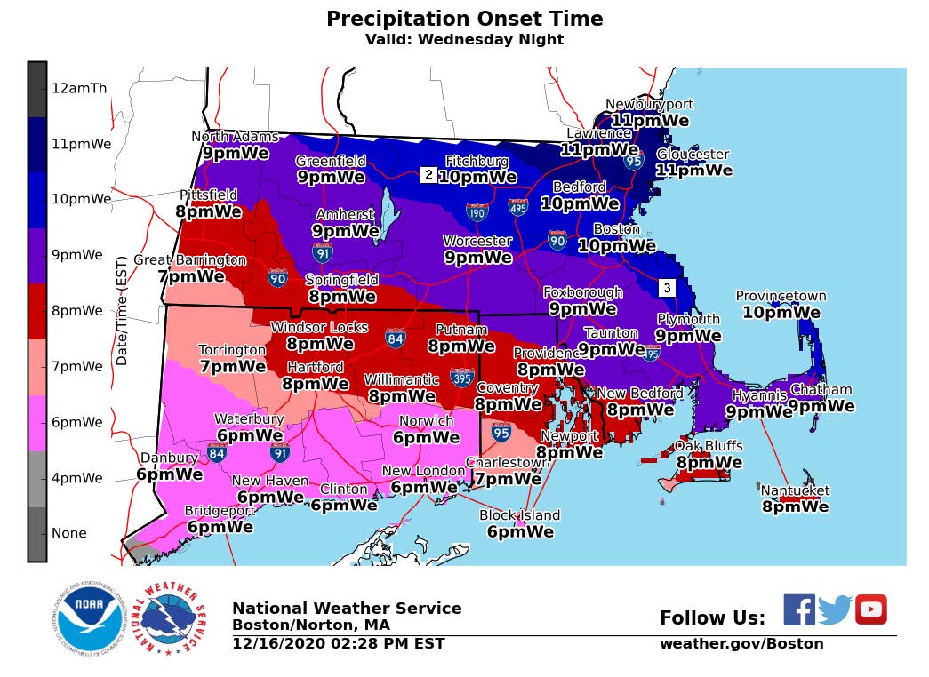
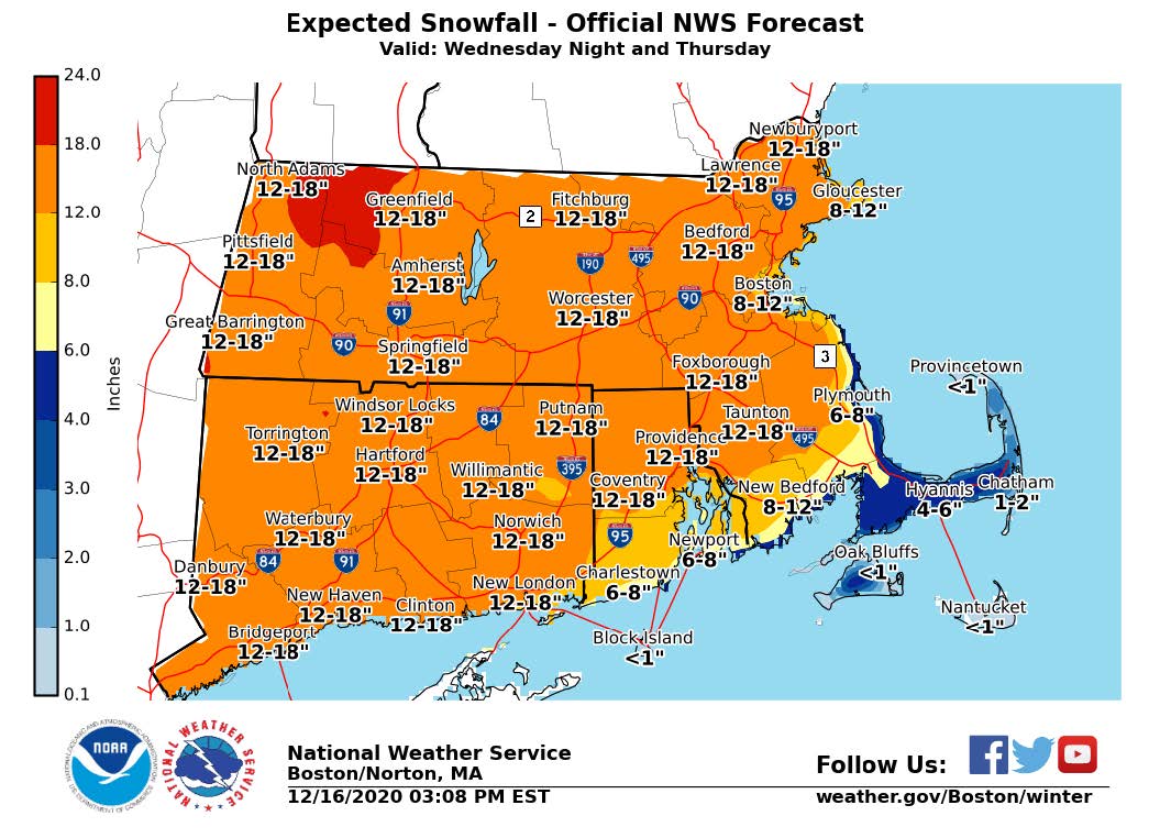
A winter storm will bring heavy snow, strong winds, coastal flooding, and hazardous marine conditions beginning between 7pm to 10pm tonight into Thursday. Expected snow fall totals projected are 8-12 inches in Southeast Massachusetts along/south of Mass Pike. Expected snow fall totals across interior Massachusetts have increased to 12-18 inches. Peak snowfall rates of 1- 2” are expected to occur in the overnight hours. Snowfall will taper off from west to east starting Thursday morning and ending statewide by early to mid-afternoon. Dry weather paired with colder temperatures and wind chill are anticipated on Thursday and Friday following the storm.
Impacts
- Significant snow accumulation is anticipated in southeastern Massachusetts creating issues with travel and commuting on Thursday morning.
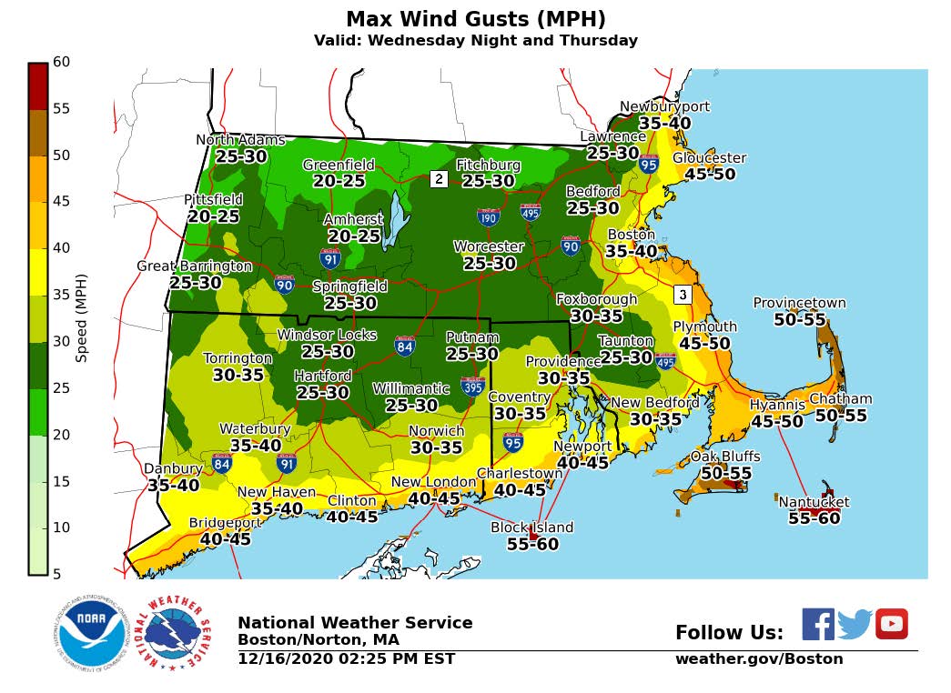
- Strong wind gusts
- Blowing/drifting snow
- Isolated/scattered power outages
- Wind gusts between 45 – 55MPH along the coast and over Cape Cod and the Islands.
- Winds will increase around midnight with the strongest wind gusts occurring between 7am and 1pm Thursday.
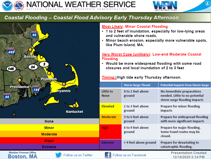
- The Massachusetts coast including Cape Cod and the Islands could see minor to low- end moderate coastal flooding (1-2 feet of inundation) during high tide on early Thursday afternoon.
- Flash freezing causing slick roads due to rapidly freezing temperatures may occur mid to late Thursday morning in in southeastern MA.