December 14, 2020 Weather Update | Coastal system may impact southern New England Wednesday night-Thursday time frame
Published on: December 14, 2020
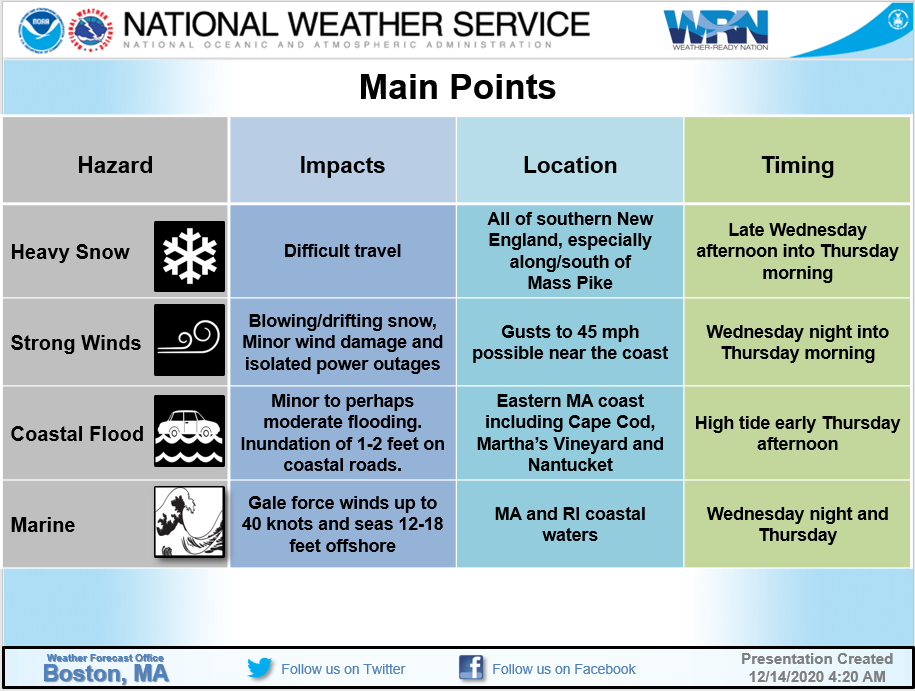
Below please find the most recent information from the National Weather Service Boston regarding the potential winter storm for Wednesday night and Thursday:
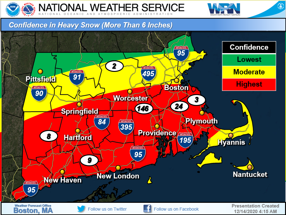
- Storm track is still not clear. If it passes farther offshore than shown in the map below, it would produce the most snow along the south coast, Cape Cod, and Islands with less snow farther to the north. A closer track would bring heavy snow to most of southern New England.
- The map below shows where we are most confident in seeing 6 inches of snow or more right now. This area may shift north or south in later forecasts.
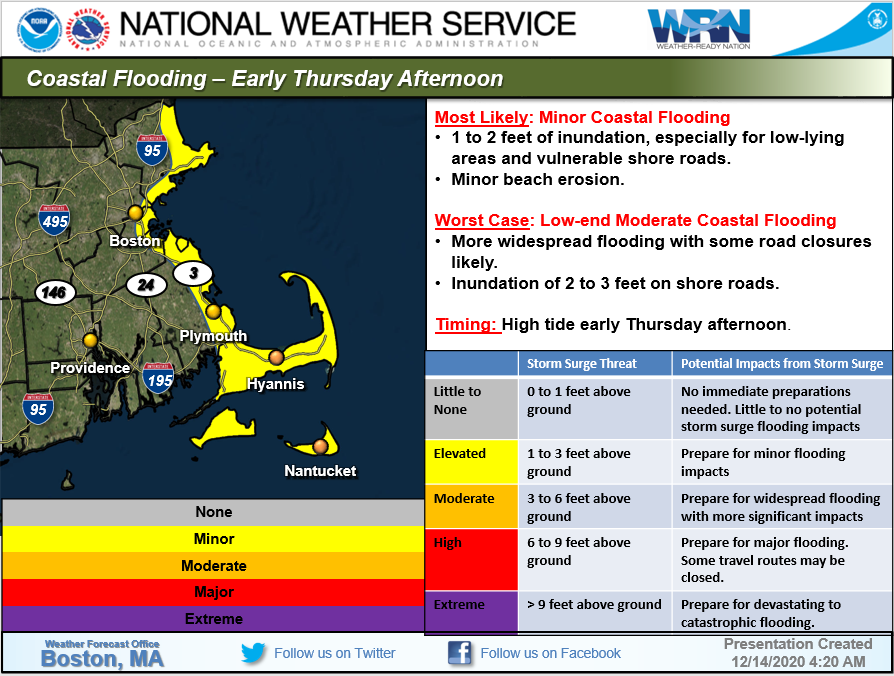
- Minor coastal flooding is expected during high tide Thursday afternoon along the eastern Massachusetts coast. There is a low chance of seeing moderate flooding, primarily from Plymouth County to the bay side of Cape Cod, but that is unlikely right now.
We’ll continue to provide updates as the forecast is refined.